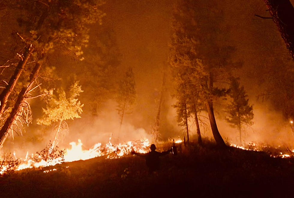

Forest Fires Are All Around – A Brief Roundup
The saying is, "Where there's smoke, there's fire." Well, we've got a lot of smoke in the Bitterroot Valley and Missoula, so there must be a lot of fire. And there is - in Idaho and Montana.
The Bitterroot Valley is being smothered by smoke from the Dixie Fire, south of Grangeville, Idaho. It has grown to over 17,198 acres as of Tuesday morning, and the nearby Jumbo Fire is at about 1,000 acres. The Dixie Fire has been growing in all directions, according to the Nez Perce-Clearwater Forest officials. Idaho firefighters are also fighting six huge fires south of Lewiston, Idaho, including the 158,000 acre Snake River Complex. Add that acreage to the other five blazes and you increase the size to over 250,000 acres. The prevailing winds are bringing that smoke our way.
The Nez Perce-Clearwater and the Lolo National Forests are combining to fight fire at the Montana-Idaho border near Lolo Pass. The Granite Pass Complex is at 1,134 acres as of Tuesday, July 13, and includes Montana's Lolo Creek Fire and Idaho's BM Hill and Shotgun Fires. Structure protection is being done at Lolo Hot Springs and Granite Hot Springs areas. The Lolo Pass Visitor Center is closed and several forest service roads and trails are closed. Those traveling U.S. Highway 12 over Lolo Pass should use caution and please don't stop along the way to take photos.The two states' Transportation Departments have the latest travel information.
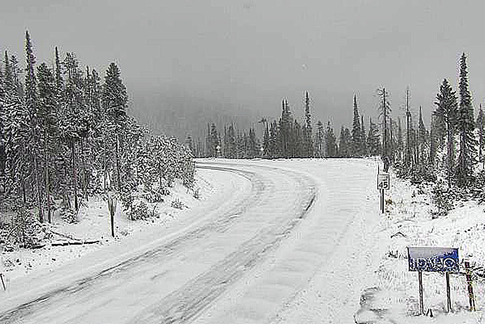
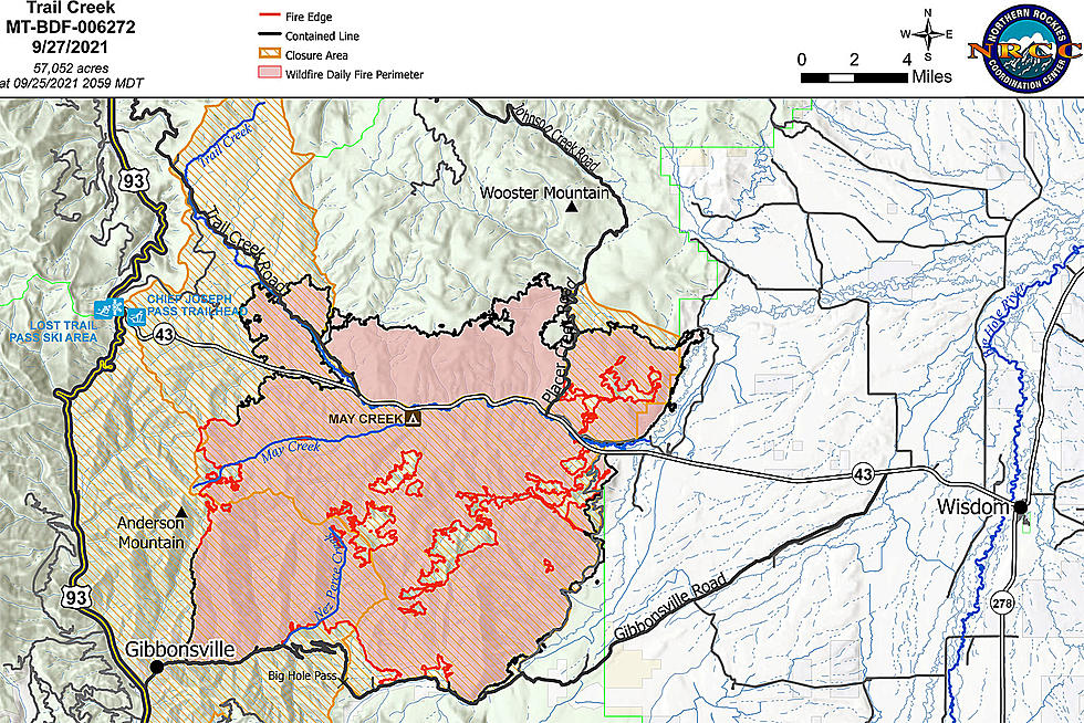
The Montana Department of Transportation has information about Highway 43, south of the Bitterroot Valley. That access to the Big Hole is closed from Wisdom over Chief Joseph Pass to the junction with US 93 at Lost Trail Pass. The Trail Creek Fire, 20 miles west of Wisdom on the Beaverhead-Deerlodge National Forest, has jumped to over 5,383 acres this week. The road closure allows fire traffic access to the firelines. And hikers, a portion of the Continental Divide Trail is closed, too.
The Alder Creek Fire, 8 miles west of Wise River, also on the Beaverhead-Deerlodge National Forest, is now over 1,380 acres and has caused closure of Bureau of Land Management lands southwest of Highway 43.
The Lolo National Forest has over 1,358 acres burning in several fires of the West Lolo Complex in the Superior and Plains-Thompson Falls area. Firefighters on the Lolo forest are also at the Brewster Fire by Rock Creek, about 8 miles south of I-90, east of the Bitterroot Valley. So far, the Rock Creek Road remains open.
Fire danger in almost all area forests is at the top "Extreme" danger level. And the hot, dry weather will continue for a while longer, according to the National Weather Service. With all the smoke, limit your time outside. And check the latest conditions before you head out.
LOOK: Famous Historic Homes in Every State
More From 96.9 Zoo FM